
- GeoData
- » Projects
| Date: | 2007-2011 |
|---|---|
| Project: | uc1046 |
| Client: | East Channel Association |
| Associates: | EMU Ltd. |
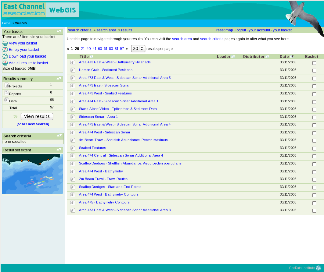
East Channel Association WebGIS
The ECA commissioned GeoData to develop and host a data catalogue and WebGIS for access and visualision of relevant geospatial data.
The East Channel Association (ECA) is formed of five leading companies within the UK marine aggregates industry, aiming to ensure that the environmental impacts of their work across the whole of the region are properly assessed, monitored and mitigated as appropriate and consulting with key stakeholders and interested parties.
The ECA commissioned GeoData to develop and host a data catalogue and WebGIS for access and visualision of relevant geospatial data. The system was developed using common open source technologies and standards, allowing users open and dynamic access to relevant data.