
- GeoData
- » Recreation + access
| Date: | 2004 - |
|---|---|
| Project: | uc0761 |
| Client: | Ben Bennetts |
| www.lamis.org.uk | |
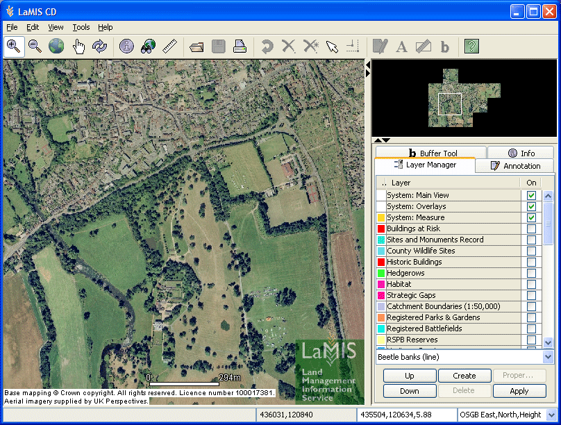
Land Management Information Service
LaMIS offers a completely new approach to sharing land-based information with farmers and rural land managers. Spatial data and land management information held by public bodies are combined with aerial photography and Ordnance Survey mapping.
The information is encrypted in a specially developed viewer to enable users to easily access the information. The result is an integrated CD-ROM based information package about a specific area of land. The service is currently available throughout England.
GeoData is managing the GIS database offered through the LaMIS Viewer, as well as developing added-value derived products and integrated decision support tools for the users of LaMIS.