
- GeoData
- » Recreation + access
| Date: | 2010 |
|---|---|
| Project: | uc1219 |
| Client: | The Nature Conservancy |
| Value: | 15,000 |
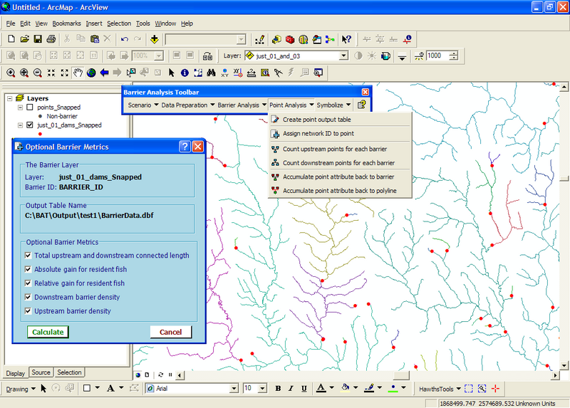
Barrier Analysis Tool (BAT)
Barriers to fish migration are an important consideration to the ecology of fish and the fisheries sector. Removal of structures blocking fish movement is a key driver in many river restoration approaches.
A tool aiding managers in quantifying the amount of river made available to fish through the removal of barriers would provide valuable information in understanding the impact of barrier removal and in evaluating the prioritisation of restoration actions.
GeoData have developed an GIS tool for processing barrier data along a river network. This tool was developed in VB .Net as a ArcMap 9.3 extension and designed to process very large datasets. It exposes itself as a tool bar and has a fully integrated Help system.
The tool takes a barrier dataset (points) and cuts up a river network (polylines) into connected networks with unique ID's. For each barrier the tool can count the number of upstream or downstream barriers\non-barriers, accumulating an attribute of the barriers\non-barriers in a downstream direction, calculate distance from network mouth or total upstream length and generate optional metrics such as barrier density or absolute\relative network gained for resident fish.