
- GeoData
- » Web
| Date: | 2009 - present |
|---|---|
| Project: | uc1145 |
| Client: | NATS |
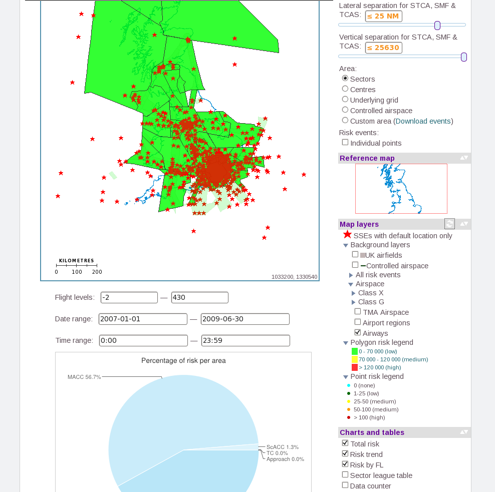
NATS - Touchstone HMI Prototype
GeoData worked closely with NATS (National Air Traffic Services) to develop a prototype interface for visualising air safety events via a sophisticated web mapping tool.
Historical datasets of events associated with flight paths are very large (millions of records) and complex, but need to be analysed to allow NATS to manage the UK airspace to minimise risk and increase efficiency around busy airports. The Touchstone prototype adds a complex spatial data model to harvested safety data, enabling real-time query and filtering to explore the data and generate custom maps on-the-fly.
GeoData achieved this using standard open source tools such as PostGIS, MapServer and OpenLayers, to deliver the required spatial indexing and processing capability in a cost-effective way.
With modern open source tools and the adoption of open standards, organisations like NATS can move from responding to near-misses or catastrophic events to an operational model of planning on the basis of calculated risk.