
- GeoData
- » Gis
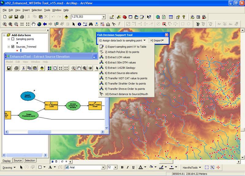
Fisheries Decision support tool - National Project
The project involved the development of GIS tools and their subsequent use for extracting information for 14 test catchments. The extracted data feeds into the development of a fisheries decision support tool.
The project took an existing ArcGIS tool and added functionality for extracting catchment information specific to a decision support tool being built for the Environment Agency.
The added functions extracted for each sampling point: British National Grid coordinates, geology, land use, elevation, slope, sinuosity and distance to source.
The tool was then run on 14 catchments and the data provided to the developer of the decision support tool.