
- GeoData
- » Gis
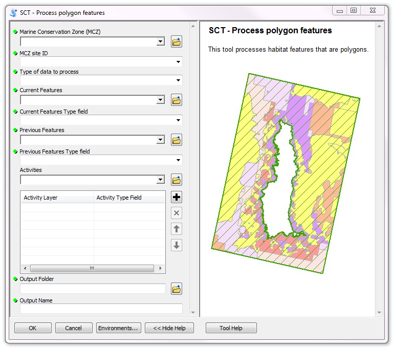
Spatial Comparison Task tool
Natural England required a GIS application to enable a GI specialist to provide spatial comparison of activities and features between years for marine sector consultations and assessments.
The tool was developed in ArcGIS 10.3 using Python. It is exposed as a geo-processing script tool which runs from ArcToolbox and was supplied with a fully integrated help system.
The tool's interface allows the user to select: Marine Conservation Zone (MCZ) boundaries, past and present habitat layers (points or polygons) and 1 or more activity layers which can be of differing geometry types.
The Tool will process all datasets or a subset if a selection existed on the MCZ layer. It intersects the habitat data with the activity datasets and generates an output table summarizing the change in activity by habitat for each MCZ. These output tables allow Natural England to report on the complex nature of activities and their potential impacts upon the MCZ.