
- GeoData
- » Gis
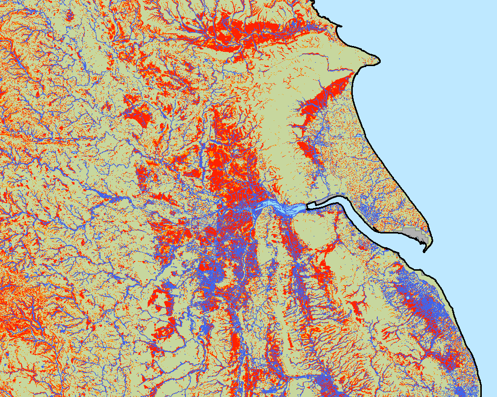
Construction of the Small Sewage Discharge Risk Zone map of England
Natural England commissioned the development of a Small Sewage Discharge Risk Zone map for England. Such a dataset can be used to explore the levels of risk from phosphorus pollution from small sewage discharge (e.g. septic tanks).
Natural England (NE) is tasked to conserve, enhance and manage the natural environment for the benefit of current and future generations. Diffuse water pollution (DWP) can come from a variety of sources and is a major cause for SSSI sites failing to meet favourable condition under the Water Framework Directive.
NE has identified the need for a risk map covering the whole of England so it can be used to inform the potential risk for new or existing small sewage discharges to ground for all sensitive SSSIs.
Following a methodology developed by May et al (2016), proximity to surface water, slope and depth to ground water were combined and scored to create the risk map of England.
The scale of data processed required advanced techniques in parallelization using the modern multi-core processors of computers.