Legal Aid Mapping
Posted 2025-05-27 10:57:07 by Admin
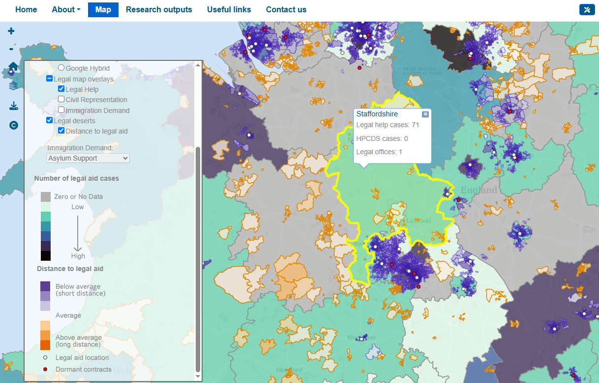 The Legal Aid Mapping project, led by the University of Sussex, investigates disparities in access to social welfare and legal aid more generally across the UK. Using a multilayered geographical and socio-legal approach, the project employs descriptive mapping to visualize demand, provision, and accessibility of legal aid services, highlighting areas known as "legal deserts" where legal assistance is scarce or inaccessible. The project aims to inform policy and support sustainable legal aid provision through knowledge exchange with practitioners and policymakers.


