Geographic Information Science (GIS) and Spatial Analysis
Our geospatial analysis specialists provide solutions for complex spatial problems in the natural, physical and social environment.
- User requirements and systems specification
- Spatial database design and development
- Environmental data capture
- Geospatial training
Recent GIS Projects
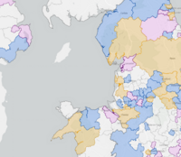
Posted 2025-05-23 11:16:07 by Duncan Hornby
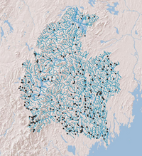
Open Rivers Network
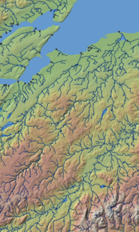
The Open Rivers Network is free dataset released under the Open Government Licence v3.0. It is built upon a 2023 release of the Ordnance Survey Open Rivers dataset. The Open Rivers Network contains ov...
Posted 2025-05-23 11:33:32 by Admin
Woodland Impacts of Development: Guidance, Evidence and Tools (WIDGET)
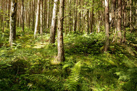
GeoData has led the technical team contributing evaluation and recommendations to the Forestry Commission on Evidence, Guidance and Tools. This multidisciplinary project was funded under Government’...
Posted 2025-05-27 10:39:47 by Admin
Health Literacy
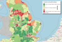
The Health Literacy tool, developed by the University of Southampton in collaboration with NHS England, offers interactive maps and data visualizations to estimate the prevalence of low health literac...
Posted 2025-05-27 10:51:30 by Admin
Active Travel Network (RATIN)
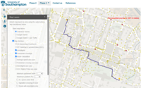
The Routable Active Travel Infrastructure Networks (RATIN) responds to the Active Travel Agenda that encourages and develops the data infrastructure to support walking and cycling for multiple transpo...
Posted 2025-05-27 10:55:33 by Admin
NASH SCOWT
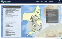
SCOWT (Shipping Constraints Online Web Tool) is an innovative platform developed by NASH Maritime to assist offshore wind developers in identifying and mitigating navigation and shipping constraints d...
Posted 2025-05-27 10:57:07 by Admin
Legal Aid Mapping
The Legal Aid Mapping project, led by the University of Sussex, investigates disparities in access to social welfare and legal aid more generally across the UK. Using a multilayered geographical and s...
Posted 2025-06-06 10:16:37 by Duncan Hornby
Barrier Assessment Tool
GeoData developed for The Nature Conservancy (USA) an ArcGIS tool that would fragment a river network using known barrier locations and compute a range of connectivity metrics. Understanding the ava...
Posted 2025-06-06 10:14:45 by Duncan Hornby
WFD49e: Development of a GIS procedure to implement a UK Geomorphic Channel Typology
SEPA had a requirement under the Water Framework Directive to assess the morphological impacts of modifications to rivers. Within Scotland this is based on the MImAS assessment methodology and feeds i...
Posted 2025-11-18 17:24:33 by Andrew Campbell-Sutton
Cultural Strategies Explorer
GeoData created a web map that displays information about cultural strategies at various Local Government levels in the United Kingdom. The map is part of an accessible Think Kit resource pack desig...


