Medieval French Roads
Posted 2025-05-27 10:49:50 by Admin
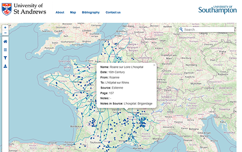 The Medieval French Roads Project offers a digital, interactive map showcasing roads and bridges in France from the 11th to the 16th centuries. This resource is built upon primary sources such as historical itineraries and unpublished manuscripts, and it includes a database with details about each mapped feature. Users can customize their view of the map by date, source, and level of detail, and it even includes features like medieval walls and city gates, aiming to be a valuable tool for those studying pre-modern travel in France.


