
- GeoData
- » Web
| Date: | 2006 |
|---|---|
| Project: | uc0858 |
| Client: | Comune di Chiesa in Valmalenco, Italy |
| Value: | 25,000 |
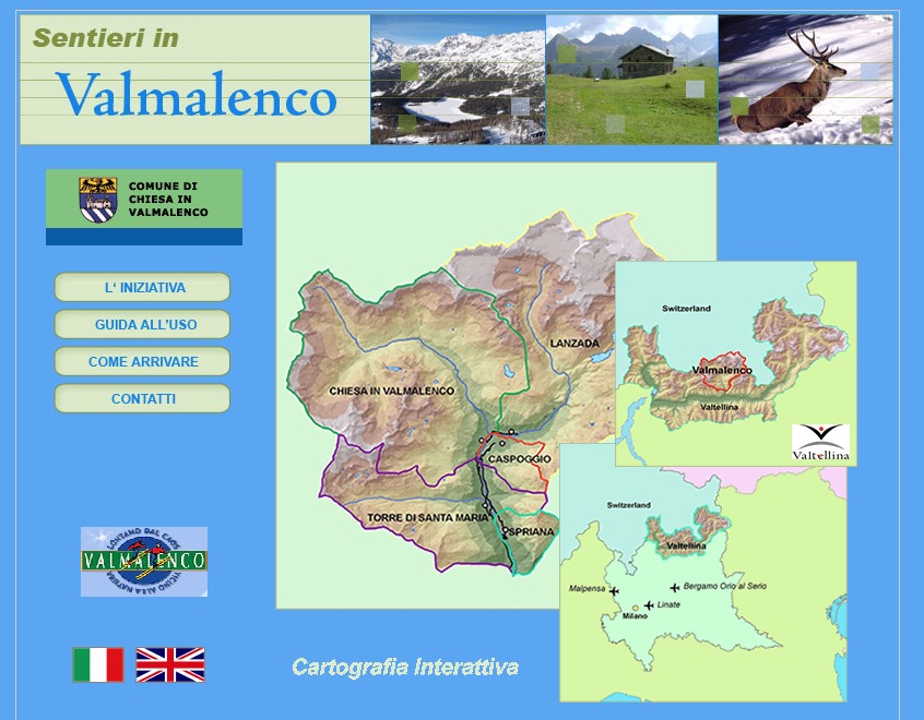
Valmalenco Walking and Tourism website
Creation of a website with WebGIS component to promote walking and other recreational activities within the Valmalenco area of the Italian Alps.
The website promoted a series of walks of varying difficulty within the region and will also provide the ability to use a map to search for promoted walks starting within a certain distance of your chosen location. It is also possible for walkers to download a map showing the route, directions, features of interest, refuges and other useful information along the route.