
- GeoData
- » Web
| Date: | 2011 |
|---|---|
| Project: | uc1265 |
| Client: | U.S. Fish and Wildlife Service Gulf of Maine Coastal Program |
| Value: | 8500 |
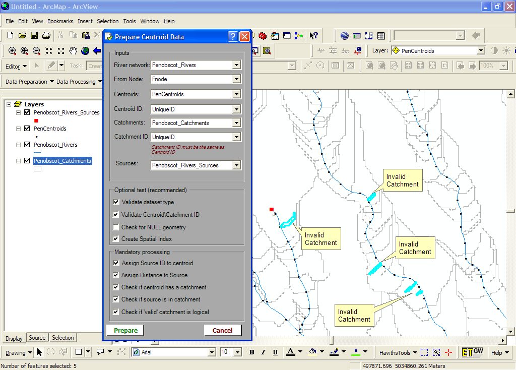
Catchment Area Correction Tool (CACT)
The U.S. Fish and Wildlife Service Gulf of Maine Coastal Program created a catchment dataset to be used for computing channel widths. Catchment delineation failed to generate reliable catchments and a tool was needed to correct this bespoke dataset.
An ArcGIS 9.3 extension developed in VB .Net was created which would traverse a vector river network identifying points with incorrectly assigned catchment area values and calculating a logical alternative for these points. The alternate area was computed by linear interpolation from the next best upstream/downstream centroids, taking into account tributary contributions.
The output would be a point dataset with logically increasing catchment area suitable for the channel width model created by the FWS.
The tool exposes itself as a tool bar in ArcMap with a fully integrated Help system.