
- GeoData
- » Web
| Date: | 2003-2004 |
|---|---|
| Project: | uc0741 |
| Client: | School of Geography, University of Southampton |
| Associates: | Prof. David Martin, School of Geography, University of Southampton |
| Value: | £6000 |
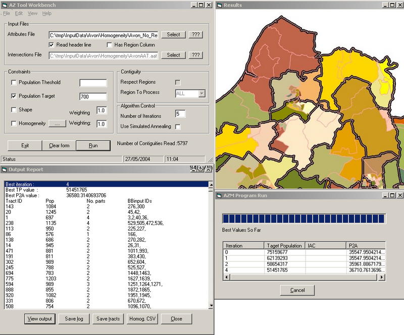
AZM - Automated Zone Matching Tool
An "Automated Zone Matching Tool" (AZM) for performing spatial redistribution of population data was developed with ESRC funding according to a specification by Professor Dave Martin in the School of Geography.
In the UK, Census data is compiled for Enumeration Districts and the results can be mapped using GIS packages. However, to be useful to researchers undertaking spatial analysis, Enumeration Districts are aggregated into larger areas known as Output Areas.
Researchers may wish to combine other types of area according to their own requirements. In deciding which of the smaller areas should be merged, census designers use variables such as the desired population, area shape as well as spatial statistical measures to ensure 'homogeneity' of distributions of age and social class. For areas of any size this task become a complex puzzle. Therefore a number of computer algorithms have been developed by academics over the years.
AZM is a repository of some of these algorithms. It is a solution that currently involves a Visual Basic program and ArcView GIS. The program performs an intensive search for the best overall solution within the constraints specified. It provides a short report indicating how well the average new area fits the targets enabling users to experiment with a range of options.