Tranquillity Mapping for Urban Greenspace Access and Healthier Journeys
Posted 2025-05-23 11:25:25 by Admin
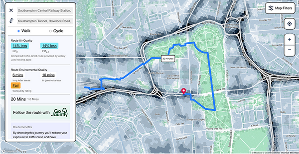 This HEIF-funded collaboration between Tranquil City Ltd and the University of Southampton’s GeoData Institute aims to develop a tranquillity index for the entire city. The project combines satellite data, perceptual field data, and machine learning techniques to model tranquillity across urban environments. By aggregating datasets and applying empirically grounded methods, the project supports healthier and more restorative urban journeys, with potential applications in planning, public health and green infrastructure design. Find your tranquil route here: https://www.sotonairmap.com/
Client: Tranquil City Ltd / University of Southampton (HEIF-fund)
Location: Southampton


