
- GeoData
- » Web
| Date: | 2012 |
|---|---|
| Project: | uc1296 |
| Client: | University of Winchester |
| www.overlandtrade.org | |
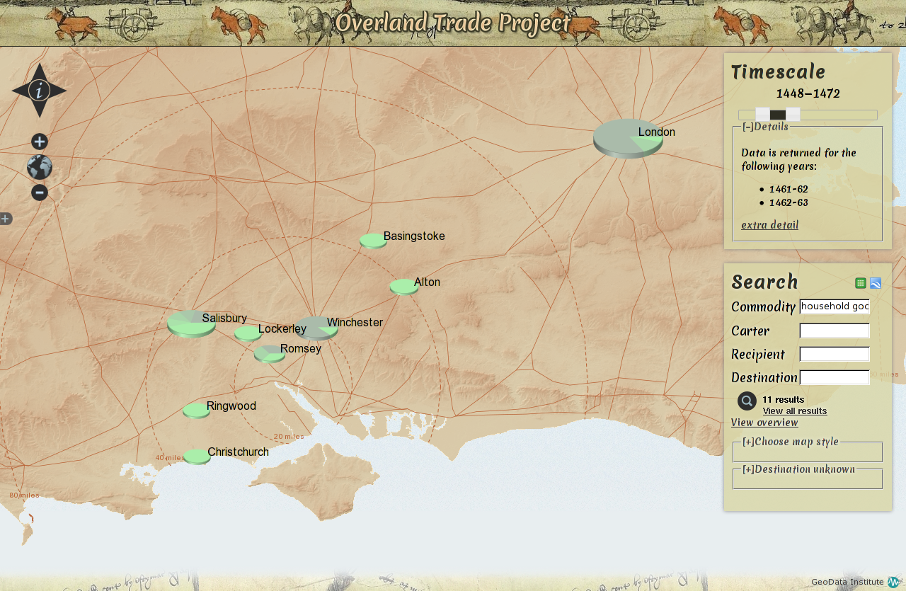
Overland Trade
A webGIS portal to present and analyse records of trade through Southampton from 1439-1540.
As part of the Southampton Record Series, a number of surviving inland trade brokage books from the middle ages have been edited and published. These records, translated from Latin, record tolls paid on goods entering or leaving the city, their destinations, their ownersip and the names of the carters carrying them.
GeoData provided some enhancements to the database to allow more statistics to be captured and GIS to be used for visualisation, at first for a 6 month slice of data and culminating in a webGIS portal to present and analyse selected brokage records from 1439-1540. The portal uses open source technologies and open geospatial standards: a schema in postgreSQL and postGIS, OpenLayers for visualisation with google charts for symbology and reporting.