Stories tagged with "rivers"
Posted 2025-06-06 10:16:37 by Duncan Hornby
Barrier Assessment Tool
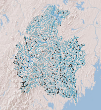
GeoData developed for The Nature Conservancy (USA) an ArcGIS tool that would fragment a river network using known barrier locations and compute a range of connectivity metrics. Understanding the ava...
Posted 2025-06-06 10:15:27 by Duncan Hornby
New Forest streams
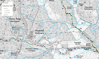
GeoData has a long history in running repeat surveys on capturing and analysing woody debris in selected New Forest streams. Originally data was captured on paper maps, but as technology improved, Geo...
Posted 2025-06-06 10:14:45 by Duncan Hornby
WFD49e: Development of a GIS procedure to implement a UK Geomorphic Channel Typology
SEPA had a requirement under the Water Framework Directive to assess the morphological impacts of modifications to rivers. Within Scotland this is based on the MImAS assessment methodology and feeds i...
Posted 2025-06-06 10:11:01 by Duncan Hornby
Sediment fingerprint tracing
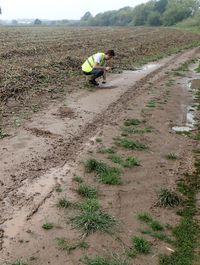
GeoData has worked in partnership with Rothamsted Research in collecting sediment and soil samples along river catchments in England and Wales to investigate and trace sediment deposition pathways. Mo...
Posted 2025-05-23 11:16:07 by Duncan Hornby
Open Rivers Network
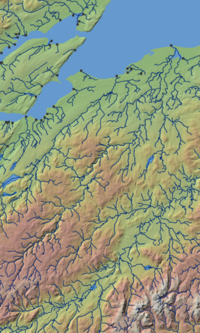
The Open Rivers Network is free dataset released under the Open Government Licence v3.0. It is built upon a 2023 release of the Ordnance Survey Open Rivers dataset. The Open Rivers Network contains ov...


